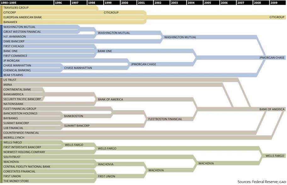
 Whoa. Kind of puts it all in perspective.
Whoa. Kind of puts it all in perspective.
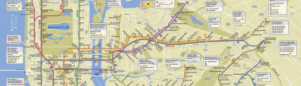
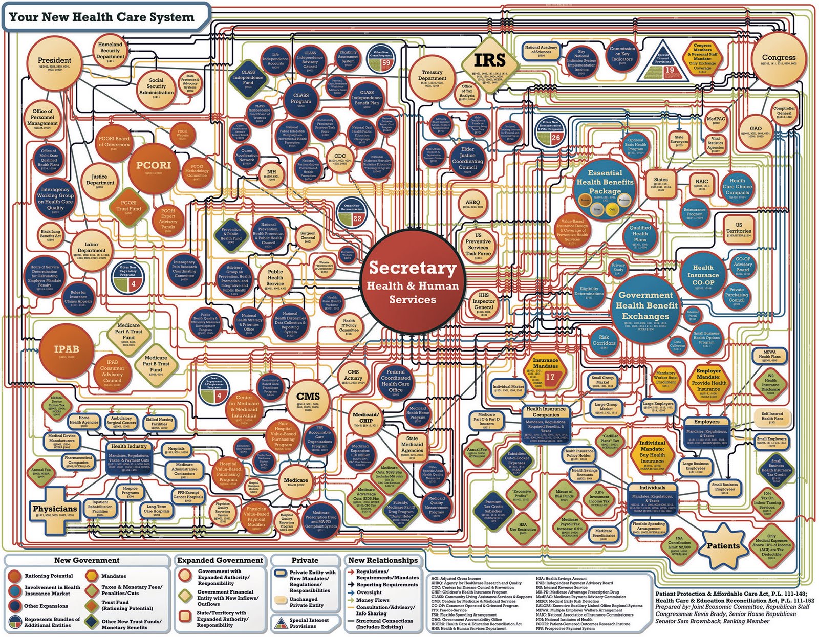 It makes me think that every subway line in the world has been repurposed to run over everyone in need of health insurance. It also makes me suspect the motives of the mapmakers.
 Gerrymandering is an interesting use of maps to political ends. I remember reading about how computers have really changed this, allowing for much more precise (and ludicrous) redistricting in the last two censuses (2000 and 2010) that can target political maps on a per-household basis.
The following article on redistricting in the 2010 Census is a good overview; definitely click-through to the original article for good illustrations and links — the website referenced provides amazing examples of gerrymandering today.
Continue reading
http://www.youtube.com/watch?v=n8zBC2dvERM
Hat tip to Rob Baker-White for reminding me of this.