Visual maps of languages are fascinating to me, since they chart so many other things — cultures, ethnic groups, historical events (invasions, immigrations and emigrations, royal marriages and other forced mergers) and more. This one is great because it maps it to words for geographical features; I’m amazed at how well it clusters! It also reminds me of how confused I was when I first moved to the northeast at the preponderance of “-kills” in the Hudson River Valley (Peekskill, Catskill, Fishkill — lots of animals being killed…) until someone explained it to me.
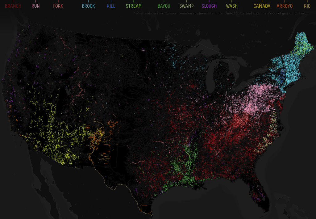
This map charts the rich variety of waterflow toponyms in the US, which reflects the climatological and geographical diversity of the country, but also its linguistic and historical heritage. River names seem extremely resistant to change, and indeed often are echoes of earlier dominant cultures [1].
The colours on the map, which is based on the place names in the USGS National Hydrography Dataset, correspond to the generic toponyms for waterflows, excluding the two commonest ones (river and creek, rendered in gray).
via 531 – A Rio Runs Through It: Naming the American Stream | Strange Maps | Big Think.
I definitely recommend clicking through and reading the whole post, which includes more explanation of each color and word (and word origin.)