By Caroline Bruno
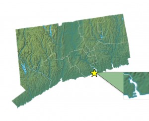
Growing up, I was surrounded on all sides by water. I could swim in Long 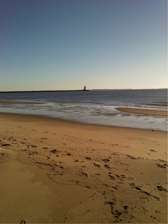 Island Sound, kayak on the Connecticut River or one of its coves, and lie on one of the many beaches that formed the lengthy coastline of Old Saybrook, Connecticut – the little town that marks where the Connecticut River meets Long Island Sound.
Was this coastline always there? Or more importantly was this piece of land always here? Here, there… over the course of Earth’s history so much movement rattled the continents that nothing stayed still for long. Where has Old Saybrook been?
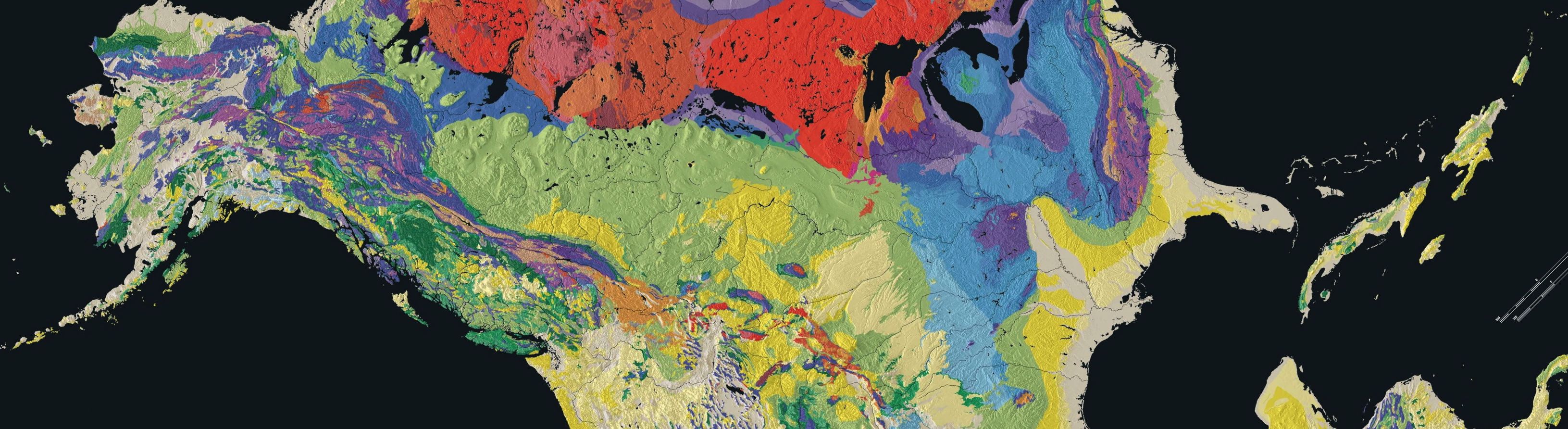
Since the formation of the earth, tectonic plates have been shifting, colliding, and crumbling. Though the earth is estimated to be 4.54 billion years old, no sediment on its surface is nearly this old. None of the earth’s oldest sediment is found in the New England area. In fact, the sediments under Old Saybrook probably don’t date back further than 443 million years to the Silurian Period. The continental plate that makes up North America today did not include present day New England until a series of exotic terranes, or small pieces of land from other areas “foreign” to the larger landmass, collided with it.
Old Saybrook lies on the Avalonian terrane, which accreted on to the North American continent through sea floor spreading and oceanic plate subduction. When a continental tectonic plate and an oceanic tectonic plate meet, the oceanic plate is subducted, which means that it is sucked down and melted in the mantle. These plates collide because of the force of sea floor spreading from magma flowing out from the mantle to form new crust near ocean trenches. Avalonia was probably originally a volcanic island composed of igneous rocks that metamorphosed when it accreted because of the extreme pressure over millions of years. Today Old Saybrook is made up of gneiss from these metamorphosed igneous rocks. This continental accretion made up the Acadian orogeny and ended around the Devonian period[1].
Even after Old Saybrook’s formation and New England’s accretion, the land was nothing like it is today because of North America’s location just south of the equator. This of course made the temperature much hotter, with just a dry and wet season. To compound this, a global greenhouse period of increased temperatures began due to additional carbon dioxide in the atmosphere and the ocean’s low albedo (oceans absorb much more of the sun’s heat than they reflect and with more ocean water, the earth’s surface warms). There were no ice caps at the poles and the resulting high sea level formed a shallow freshwater lake to the west of Old Saybrook.
Then as the continents converged in the Permian, Old Saybrook was squished between the North American continental plate and Gondwana (present day Africa, South America, Antarctica, and Australia) forming Pangaea. Once Pangaea broke apart in the Jurassic period, Old Saybrook drifted up to where it is today in the northern hemisphere. The rifting from the continental fragmentation caused major erosion and deposition of sediment in many parts of Connecticut. These deposited sedimentary layers were able to preserve fossils in many parts of Connecticut neighboring Old Saybrook, but not in the Essex or Old Lyme Quandrangles (the geologic areas that encompass Old Saybrook).
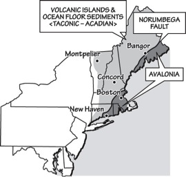
- Old Saybrook is east of New Haven in Connecticut, making it part of Exotic Terrane Avalonia. From the Teacher Friendly Guide to the North East
The discovery of these Jurassic fossils prompted the creation of Dinosaur Park, which contains a surprisingly diverse and abundant amount of dinosaur trackways and evidence showing Triassic and Jurassic climates. Pieces of evidence for the End Triassic Extinction and trace fossils (show movement and behavior rather than physiological structure) of therapods have been preserved here. The extinction is “clearly indicated by the disappearance of typical Triassic pollen and spores”[2] from the fossil record in this area. The dinosaur trackways have also been important in figuring out what kind of life was able to live in this area around 550,000 years after the End Triassic Extinction. The tracks can tell us the shape and size of the dinosaurs’ feet characterized by distinct claw marks, and also the body size based on the distance between prints or the stride length. It is evident that these were bipedal, meaning they walked on two feet, and their hips were probably six feet tall. This is large for a therapod and could be due to a lack of competition after the widespread extinction. There is evidence for the shallow body of water near Old Saybrook I mentioned above, along with numerous freshwater fauna well preserved in areas of low oxygen mud. Though fossils could not be preserved in the igneous and metamorphosed rocks when this area formed, evidence from subsequent sedimentary rocks gives us a good idea of the climate and diversity of life in Southeastern Connecticut.
Today Old Saybrook’s economy is highly dependent on tourism, as the population doubles in the summer months. During these times, beautiful wetlands and beaches draw people to Old Saybrook and the surrounding areas. Today there is growing concern that erosion and rising sea level will destroy these fragile marine (ocean) and fluvial (river) ecosystems. A recent study aimed to assess the damage that has been done by humans to these wetland systems. Severe weather events, changing sediment supply, and river diversion all seem to be first indications of the possible further destruction by human forces. The current changes in morphology (structure and features) of the Connecticut coast is minimal compared to the drastic changes that it has been through in the past. However, changes today are occurring over the course of decades rather than millennia and pose a problem for industries and residents in these areas. More and more people are looking for waterfront property, but these developments are damaging the remaining marshland and waterside habitats.
Today it is difficult to connect the geologic history of the rock and fossil record to the changes in our current landscapes because the short time scale we use to address current changes is vastly different from the long term changes recorded from the past. Even so, communities like Old Saybrook, vulnerable to flooding, habitat loss, and economic instability, depend greatly on climatic and geological changes, making it worth the time and effort to consider these interconnections.
[1]http://geology.teacherfriendlyguide.org/index.php?option=com_content&view=article&id=61:exotic-terranes-the-making-of-new-england&catid=36:geologic-history&Itemid=81
[2] Witkowski, page 32


